CADMAP Limited Delivers Precision 3D Surveying for Bespoke Client Projects across London
“UK Surveying Experts Deliver Bespoke 3D Laser Scanning, Measured Building Surveys, and Topographical Mapping for Complex Redevelopment Project”
📞 Call: 01483 429385
📧 Email: info@cadmap.co.uk
🌐 Visit: www.cadmap.co.uk
A Complete Multi-Survey Package Tailored to the Client’s Needs
At CADMAP Limited, we’re known for our ability to deliver precision data for architects, developers, engineers, and property professionals. Our latest project showcased this ability with full scope, tackling a challenging property survey using a combination of advanced surveying technologies.
This bespoke project involved a historic property undergoing significant renovation and redevelopment. Our client required an accurate, fully detailed understanding of both the external and internal features of the site — including all elevations, internal floor plans, roof structure, and surrounding landscape.
CADMAP was commissioned to provide: https://www.cadmap.co.uk/
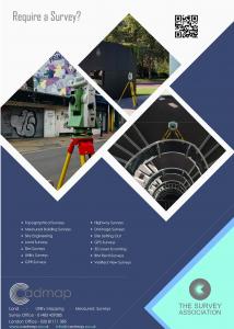
3D Laser Scanning
Measured Building Surveys
Detailed Floor Plans and Elevations
Roof Plans
Topographical Surveying
Advanced Technology: 3D Laser Scanning & Total Stations
To capture the level of detail required for this project, our experienced surveying team deployed a combination of:
High-resolution 3D laser scanners, and
Precision robotic total stations
The 3D laser scanners allowed us to capture millions of data points (point cloud data) from every angle of the property, enabling us to model even the most intricate architectural features and structural nuances.
Meanwhile, our total stations were used to cross-reference, control, and verify the data – ensuring sub-centimetre accuracy across all measurements.
This hybrid method gave us the ability to map internal spaces, external elevations, and surrounding terrain seamlessly, while remaining non-intrusive – an essential factor for working on sensitive or occupied properties.
Deliverables: Floor Plans, Elevations, Roof & Topographical Survey
Our client requested a suite of deliverables that would support both architectural redesign and planning submission.
We provided:
✅ Measured Floor Plans https://www.cadmap.co.uk/surveying/measured-building-surveys
Including walls, doors, windows, staircases, sanitaryware, and fixtures
Floor levels and heights were carefully recorded and referenced
✅ External Elevations
Full architectural detail from eaves to foundation
Clean, readable line work exported in CAD and PDF formats
✅ Roof Plan
Including slope directions, ridges, valleys, chimneys and gutter lines
Accurate to support future solar panel installation or refurbishment
✅ Topographical Survey https://www.cadmap.co.uk/surveying/land-topographical-surveys
Covering the garden, pathways, outbuildings, boundary features, tree positions, and spot levels
Ideal for landscaping design, drainage planning, and construction layout
Each dataset was fully referenced to site control points, cross-checked for consistency, and delivered in multiple formats including AutoCAD DWG, PDF, and Revit-ready point cloud data upon request.
Why This Matters: Planning with Confidence
This level of detail gave the client and their architectural design team the confidence to:
Move forward with structural designs
Apply for planning permission with supporting data
Understand the site’s constraints and potential
Coordinate services and design effectively
In an environment where design changes can cost thousands, accurate survey data at the start of a project is not just helpful — it’s essential.
A Commitment to Accuracy and Client Satisfaction
This project reinforces CADMAP Limited’s reputation as one of the UK’s most trusted land and building survey firms.
Our clients choose us for:
✅ Fast turnaround times without compromising detail
✅ Full UK coverage, including London, Sussex, Surrey, Hampshire, and Berkshire
✅ Specialist surveying for architects, planning consultants, developers, and homeowners
✅ Modern equipment and experienced staff who know how to deliver
With more than a decade of surveying experience, we pride ourselves on offering surveying services tailored to the specific requirements of each project.
Whether the site is historic, complex, remote or undergoing planning scrutiny, CADMAP has the tools and expertise to deliver.
https://www.cadmap.co.uk/
Services We Offer
At CADMAP, we provide a wide range of surveying solutions, including:
3D Laser Scanning / Point Cloud Capture
Measured Building Surveys
Topographical Surveys
Elevation and Section Drawings
Roof Plans and Site Layouts
BIM-Ready Models and Revit Integration
Boundary and Legal Mapping
Drone Surveys (UAV Mapping)
Our team uses the latest Leica, Trimble, and FARO equipment, paired with industry-standard software such as AutoCAD, Revit, and Cyclone to produce flawless outputs.
Trusted by Professionals Across the UK
From residential developments to commercial refurbishments, public sector contracts, and bespoke private builds, CADMAP Limited supports construction professionals across the board.
Recent clients include:
Architects and Planning Consultants
Structural and Civil Engineers
Estate Managers and Developers
Property Investors and Owners
Local Authorities and Historic Preservation Teams
No two sites are ever the same, and neither are our solutions. Every CADMAP survey is tailored, scalable, and quality-assured.
Looking for Surveying Experts?
If you need measured building surveys, 3D laser scanning, or topographical surveys for your project, speak to the team at CADMAP Limited today.
📞 Call: 01483 429385
📧 Email: info@cadmap.co.uk
🌐 Visit: www.cadmap.co.uk
https://www.cadmap.co.uk/surveying/cctv-drainage-surveys-london
We’re happy to quote for projects large or small across London, Sussex, Surrey, Hampshire, Berkshire, and beyond.
Andy FInn
Cadmap Limited
+44 1483 429385
email us here
Visit us on social media:
LinkedIn
Instagram
Facebook
YouTube
X
Services
Distribution channels: Agriculture, Farming & Forestry Industry, Building & Construction Industry, Energy Industry, Movie Industry, Real Estate & Property Management
Legal Disclaimer:
EIN Presswire provides this news content "as is" without warranty of any kind. We do not accept any responsibility or liability for the accuracy, content, images, videos, licenses, completeness, legality, or reliability of the information contained in this article. If you have any complaints or copyright issues related to this article, kindly contact the author above.
Submit your press release


